Human Settlements Notes 12th Geography
12th Geography Lesson 2 Notes in English
2] Human Settlements
Introduction
- Look at the front image of an oasis.
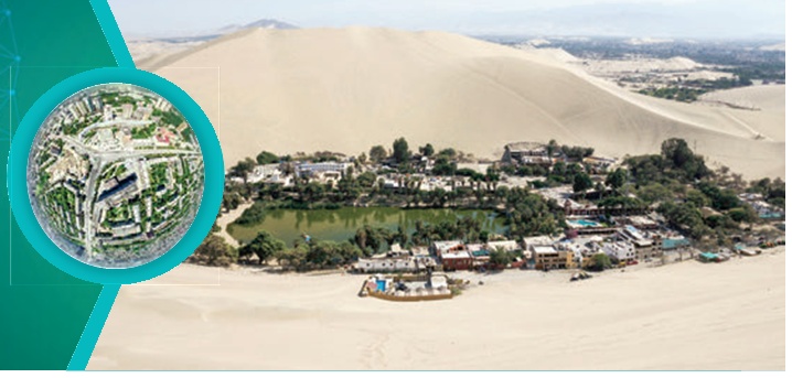
- It is an aerial view of the Huacachina oasis in Ica, Peru, 300 km south of Lima.
- The settlement is home to 96 residents, who live around the lake.
- In simpler term we can define settlement as any form of human habitation which ranges from a single dwelling to a large city.
- A human settlement is defined as a place inhabited more or less permanently.
- It includes building in which they live or use and the streets through which they travel.
- It also includes the temporary camps of the hunters and herders.
- It may consist of only a few dwelling units called hamlets or big cluster of building called urban cities.
Origin and development of Settlement
- Most anthropologists believe that humans first appeared in the Great Rift Valley of East Africa thousands of years ago.
- From there, they spread to the Middle East, Asia, Europe, America and Oceania.
- Neolithic Revolution (Agricultural Revolution) occurred in Mesopotamia, people went from hunter- gatherers and nomads to domesticators.
- The population grew relatively quickly.
- The emergence of urban population occurred also in some areas. Agriculture became especially successful largely in the river valleys of Nile, Ganges and Yangtze kiang.
- These areas had fertile soil from annual flooding which led to abundant harvest.
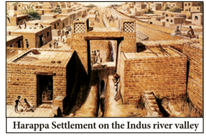
- First cities arose in these areas and people were able to grow surplus food to feed a non- farming urban population thereby leading to specialization among the population.
- The priests, scribes, architects, farmers, soldiers, Straders, blacksmiths, etc. were some other people ventured in these areas.
Site and Situation
Site
- The Site of a settlement describes the physical nature of where it is located.
- Factors such as water supply, building materials, quality of soil, climate, shelter and defence were all considered when settlements were first established.
- For instance, the site of Sydney, in Australia, initially took advantage of the excellent natural harbour and surrounding fertile farmland.
- Aspect and shelter are two of the most important factors that were considered when deciding where to locate a settlement.
- Aspect relates to the direction in which the land faces.
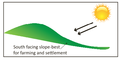
- In the Northern Hemisphere the best slopes to locate on are those that face south, as they will receive the most sunshine, and therefore be the best for agriculture.
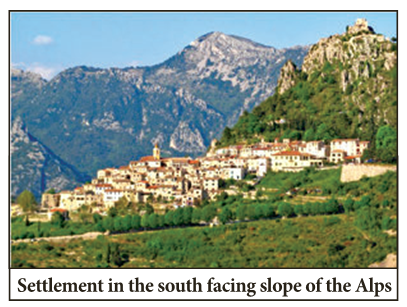
- This can be seen clearly in many of the valleys of the Alps, where settlements have located on the south-facing slopes.
- Shelter is also very important, particularly from the cold northerly winds and prevailing south westerly winds in the UK.
- A good example of settlements being sheltered by their natural surroundings are the many spring-line settlements found along the base of the chalk escarpments of the North and South Downs.
- These settlements would also have benefited from the good water source and fertile farmland nearby.
1. Water supply
- Water supply is probably the single most important factor in deciding where a settlement might be located.
- Not only do rivers provide a source of clean drinking water, they also provide a food source through fishing, and a transport route.
- Most of the world’s largest cities are located on rivers, especially the point at which they reach the sea, as this was often the first point that explorers landed.
2. Dry point sites
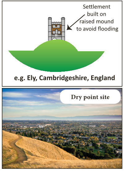
- A dry point site is one that is slightly raised from the surrounding area, meaning that it is less likely to flood. Ely in Cambridgeshire, England, is a good example of dry point site.
3. Wet point sites
- Wet point site refers to any site that has access to water, usually through being beside a river.
- Towns would either grow up along the river or clustered near the point at which the river enters the sea.
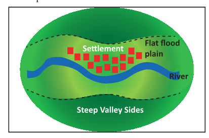
- Examples of wet point sites include the towns and villages of the Welsh valleys, which tend to extend along the flat valley floor, rather than up the steep valley sides.
- Spring line settlements in the North and South Downs, England are also good examples of wet point sites.
4. Defence
- In medieval times, defence was one of the most important factors influencing the site of a settlement.
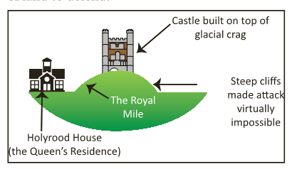
- The relief of the land often proved to be the best form of defence.
- Edinburgh castle sits on the top of a glacial crag, in an almost perfect position to defend itself, with very little chance for the attackers.
- In Italy, there are many walled hill-top villages, whilst the Maoris in New Zealand built their settlements (called Pa’s) on the top of steep hills to prevent being attacked.
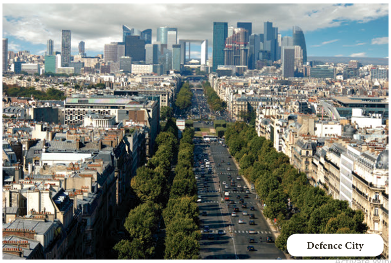
- In India, Ichhapur Defence Estate is a census town in Barrackpore, West Bengal.
- The other common natural feature used for defence is water, and in particular rivers.
- Both Shrewsbury and Durham are very good examples of where a meander of the river has formed an area of land bounded by water on three sides.
- This provided both cities with excellent defence, as they only had a thin neck of land to defend.
5. Resources
- The idea of resources covers a huge number of different things.
- For early settlers the most important resources were fuel, building materials and food.
- Settlements grew in areas where wood was plentiful, stone easily accessible and good soil allowed agriculture to be developed.
- Since in early days of settlement many different resources have become the focal points for the growth of urban areas.
6. Mining
- The coal mines of South Wales, Tin mines of Cornwall and large mining projects at Carajas in Northern Brazil, have all encouraged the rapid growth of settlements aimed at housing the workers and providing them with all that they require.
7. Precious metals
- Settlements in South Africa have grown after the discovery of large deposits of precious metals such as gold.
- The most famous settlement grew due to finding gold is San Francisco, after the gold rush to California in 1849.
8. Route centres
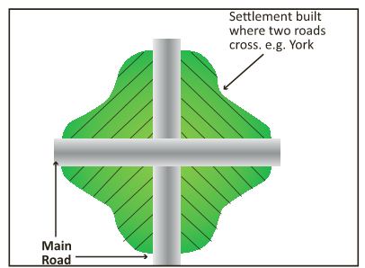
- Route centres are often called Nodal Points.
- Nodal Points are formed by the meeting of two valleys, but settlement nowadays will grow where two main roads meet.
- In the UK, York is a good example of a route centre.
- Birmingham also enjoys a very good location, where many routes join up, and this is one of the reasons for its growth to become one of the largest cities in the UK.
9. Bridging points
- Just as water is very important for drinking, fishing, irrigation and navigation, so the ability to cross the rivers is also very important.
- Many towns and cities have built up at points where it was the easiest to cross a large river.
- Exeter is one such example, crossing the river Exe in England.
- However one of the best examples is Paris in France.
- The original town was based on the tiny Ile dela Cite, which is an island in the middle of the River Seine.
- This island meant they could build two small bridges across the river rather than one large one.
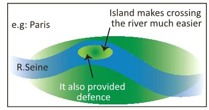
- Nowadays the island has been engulfed by the huge city that Paris has become, however it does still have many bridges going to it and is the point where the huge Notre Dame Cathedral is built.
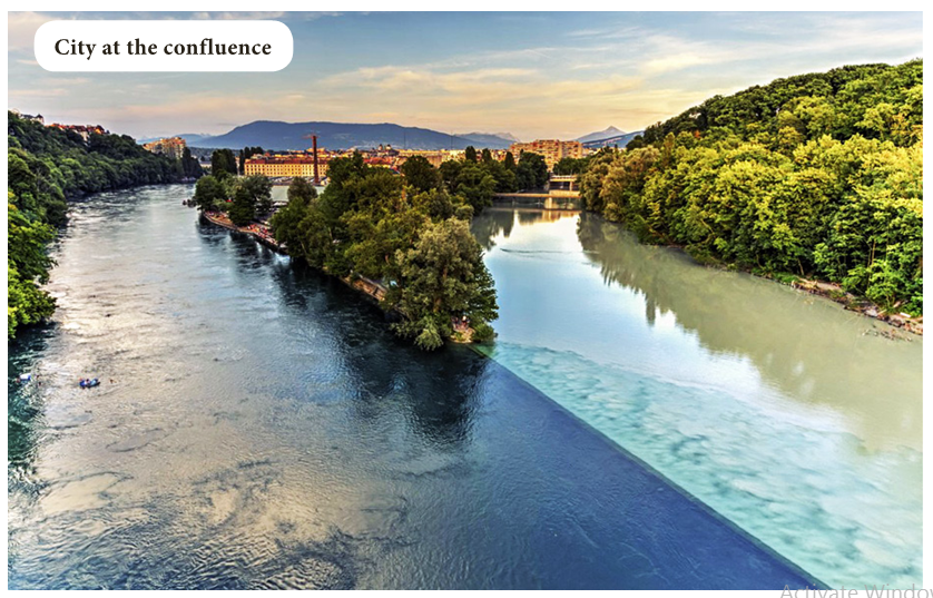
10. The confluence of two rivers
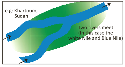
- Just as two valleys, or roads, make a nodal point for settlement growth, so do two rivers joining.
- One such example is found in Khartoum in Sudan, where the Blue and the White Nile meet.
- In India, Allahabad is located at the confluence of River Ganga and Yamuna and Bhavani (Tamil Nadu) is at the confluence of River Cauvery and Bhavani.
Situation
- The situation of a settlement is the description of the settlement in relation to the other settlements and physical features around it.
- The situation of a settlement is the most important in determining whether it grows to become a large city or stays as a small town or village.
- In the UK, Birmingham is an example of a city with excellent situation.
- It is located central to the country, with excellent links by road to the North and South to London.
- As cities begin to fulfill different functions their importance can increase or decrease.
- Their situation plays an important part in deciding which of these functions will occur.
- It refers to the location of the actual settlement.
- The initial choice of a site for a settlement depends on its meeting certain daily needs such as water supply, availability of potential farmland, building materials and fuels etc.
- Settlements can broadly be divided into two types – rural and urban.
- Let us know some differences between rural and urban areas in general.
- The major difference between rural and urban areas is the function. Rural areas have predominantly primary activities such as agriculture, whereas urban areas have domination of secondary and tertiary activities such as manufacturing industries and service sectors.
- Generally the rural areas have low density of population than urban areas.
- Urban settlements are defined by their advanced civic amenities, opportunities for education, and facilities for transport, business and social interaction and overall better standard of living whereas rural areas lack of such amenities.
- Rural areas do not have pollution or traffic problems that beset regular urban areas.
- In the rural society there was very little scope for occupational mobility. In cities there are many occupations, so occupational mobility is frequent.
- Rural people are less mobile and therefore the social relations among them are intimate. In urban areas, the way of life is complex and fast, hence, the social relations are formal.
Pattern of Rural Settlement
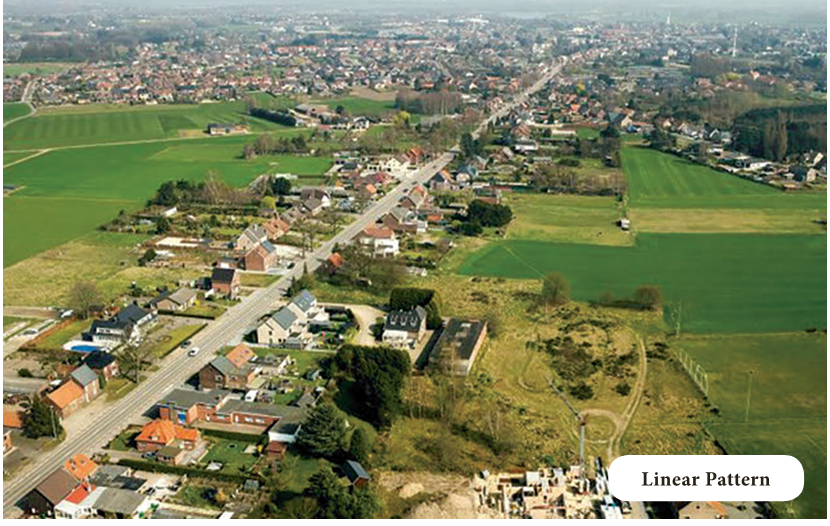
- On the basis of forms or shapes of the settlements, rural settlements are classified as Linear, Rectangular, Circular, Star like, T-shaped village, Y-shaped village, Compact, Disperse, Planned, etc.
- The settlement in which houses are constructed along a road, railway line, river, canal edge of a valley, or along a levee is known as Linear Pattern.
- The settlements constructed in a rectangular shape are known as Rectangular Pattern.
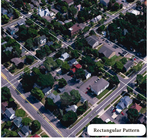
- Such kind of settlements is found in plain areas and in wide inter-montane valley.
- The settlements constructed in a circular shape are known as Circular Pattern.
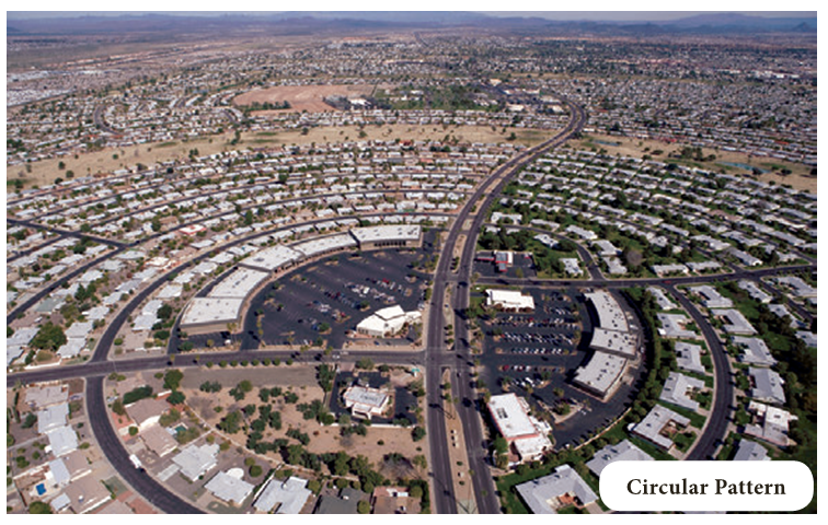
- Such kind of settlement is found around lakes, tanks, or a planned village.
- The settlements constructed in a star shape are known as Star like Pattern.
- Such kind of settlement is found around the points where several roads cross each other (making star shape).
- The settlements in which houses are constructed at the tri-junctions of the roads are known as T-shaped Pattern.
- Such kind of settlement is found along the road, which meets with another road at the dead end (the straight going road ends) and bifurcates left and right (T-Shape).
- The settlement, in which houses are constructed along the straight road, is known as Y-Shape pattern.
- It is further bifurcated into two roads (similar to Y shape).
Classification of Rural Settlement
- Based on shape, the settlements are classified as
1. Compact or Nucleated Settlements
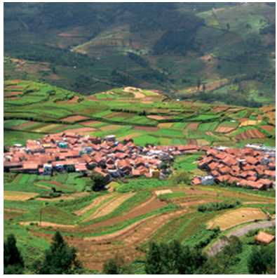
- In the nucleated settlements, the houses are built very close to each other.
- Normally, fertile plain regions have such compact or nucleated settlements.
2. Dispersed Settlements
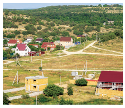
- In such kind of settlements, houses are spaced far apart and often interspersed with fields, however, their market and some other activities are centralized where they participate together.
Urban settlement
- The census of India, 1991 defines urban settlements as “All places which have municipality, corporation, cantonment board or notified town area committee and have a minimum population of 5000 persons, at least 75 per cent of male workers are engaged in non- agricultural pursuits and a density of population of at least 400 persons per square kilometers are urban settlements.
Evolution of Urban Settlement
- The first urban settlement to reach a population of one million was the city of London by around C.E. 1810. By 1982 approximately 175 cities in the world had crossed the one million population mark.
- Presently 48 per cent of the world’s population lives in urban settlements compared to only 3 per cent in the year 1800.
Stages of Urban Settlement
- Depending on the size and the services available and functions rendered, urban centers are designated as town, city, million city, conurbation, Megalopolis.
Town (Population more than 5000 people)
- The concept of ‘town’ can best be understood with reference to ‘village’.
- Population size is not the only criterion.
- Functional contrasts between towns and villages may not always be clear cut, but specific functions such as, manufacturing, retail and wholesale trade, and professional services exist in towns.
City (Population more than 100,000)
- A city may be regarded as a leading town.
- Cities are much larger than towns and have a greater number of economic functions.
- They tend to have transport terminals, major financial institutions and regional administrative offices.
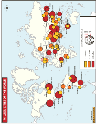
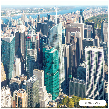
- When the population crosses the one million mark it is designated as a million city.
Conurbation (Population of 2 or more cities combined)
- The term conurbation was coined by Patrick Geddes in 1915 and applied to a large area of urban development that resulted from the merging of originally separated towns or cities.
- Greater London, Manchester, Chicago and Tokyo are examples.
- In India, Hyderabad and Cochin are the examples of conurbation cities.
Megalopolis (Population more than 10 million)
- This Greek word “Megalopolis” meaning “great city”, was popularized by Jean Gottman (1957) and signifies ‘super- metropolitan’ region extending, as union of conurbations.
- The urban landscape which stretches from Boston in the north to south of Washington in the U.S.A is the best known example of a megalopolis.
Million City (Population more than 1million)
- A city with million or more people is termed as the million city.
- The number of million cities in the world has been increasing as never before.
- London reached the million marks in 1800, followed by Paris in 1850, New York in 1860, and by 1950 there were around 80 such cities.
- The rate of increase in the number of million cities has been three-fold in every three decades – around 160 in 1975 to around 438 in 2005.
Definition of Town
- In 2001, places were designated as urban or towns on the following principles.
- All places with Municipality, Corporation, Cantonment Board, Sanitary Board, Notified Area Committee etc.
- All other places which satisfy the following criteria.
- A minimum population of 5,000.
- At least 75 per cent of the male working population being engaged in non- agricultural (and allied) activity.
- A density of population of at least 400 persons per square kilometer (or one thousand persons per square mile).
The Urban Agglomeration
- As per census 2001, it was decided that the core town or at least one of the constituent towns of an urban agglomeration should necessarily be a statutory town and the total population of all the constituents should not be less than 20,000 (as per 1991 census).
The fastest growing city of Tamil Nadu!
- Tiruppur is located at 11.1075°N and 77.3398°E on the banks of the Noyyal River.
- It has an average elevation of 295 metres (967 feet) and covers an area of 159.6 km2.
- Tiruppur was an agricultural town with irrigated farms and the farmers became small owners of various textile related units during the 1970s.
- The boom in the textile industry led to an interwoven network of the small scale units leading to growth of the city into a major textile hub.
- The recent revelation of the study conducted by Oxford Economics marked several Indian cities in top ten categories of fastest-growing cities of the world.
- Tiruppur, bags the sixth fastest growing city in India followed by Tiruchirappalli and Chennai.
Urban Agglomeration
- Urban agglomeration is a continuous urban spread constituting a town and its adjoining urban outgrowths (OGs), or two or more physical contiguous towns together and any adjoining urban outgrowths of such towns.
- Examples of Outgrowth are railway colonies, university campuses, port area, military camps etc. that may have come up near a statutory town or city but within the revenue limits of a village or villages contiguous to the town or city.
- With these two basic criteria having been met, the following are the possible different situations in which urban agglomerations could be constituted.
- A city or town with one or more contiguous outgrowths.
- Two or more adjoining towns with or without their outgrowths.
- A city and one or more adjoining towns with their outgrowths all of which form a continuous spread.
Standard urban area
- A new concept that had been developed for the 1971 Census for the tabulation of certain urban data was the Standard Urban Area.
- The essential of a Standard Urban Area are:
- It should have a core town of a minimum population size of 50,000.
- The contiguous areas made up of other urban as well as rural administrative units should have close mutual socio- economic links with the core town and
- The probabilities are that this entire area will get fully urbanized in a period of two to three decades.
- The idea is that it should be possible to provide comparable data for a definite area of urbanization continuously for three decades which would give a meaningful picture.
- This replaced the concepts of Town Group that was in vogue at the 1961 Census.
- The town groups were made up of independent urban units not necessarily contiguous to one another but were to some extent inter-dependent.
- The data for such town groups became incomparable from census to census as the boundaries of the towns themselves changed and the intermediate areas were left out of account; this concept came for criticism at one of the symposium of the International Geographic Union in 1968 and the concept of Standard Urban Area came to be developed for adoption at the 1971 Census.
- If data for this Standard Area were to be made available in the next two or three successive censuses, it is likely to yield much more meaningful picture to study urbanisation around large urban nuclei.
Basis for classification of urban settlements
- The definition of urban areas varies from one country to another.
- Some of the common bases of classification are size of population, occupational structure and Administrative setup.
Population size
- In India the size of population, density of 400 persons per sq km and share of non-agricultural workers are taken into consideration.
Occupational structure
- In India if more than 50 per cent of its economically productive population is engaged in non-agricultural pursuits.
Administration Setup
- For example, in India, a settlement of any size is classified as urban, if it has a municipality, Cantonment Board or Notified Area Council.
Classification of Urban Settlement
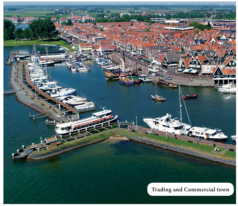
- Depending upon the functionality of the urban settlement, towns are classified as Administrative Towns, Commercial Towns, Cultural Towns, Recreational Towns, and Industrial Towns.
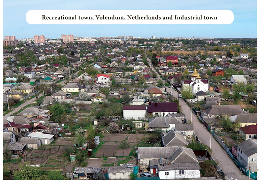
- The settlements that established for the administrative purpose or having largely administrative function are known as administrative towns.
- For example, Washington D.C., New Delhi, Canberra, Paris, Beijing, Addis Ababa, and London etc.
- The settlements that facilitate commercial opportunities are known as trading and commercial towns.
- For example, Agra, Lahore, Baghdad as an important transport node; Manchester and St Louis in land centers; Winnipeg and Kansas City as agricultural market towns; Frankfurt and Amsterdam as banking and financial centers; etc.
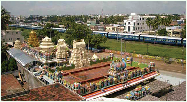
- The settlements established because of religious adherence are known as cultural or religious towns.
- For example, Jerusalem, Mecca, Jagannath, Puri, Madurai and Varanasi, etc.
- The settlements established for the recreational purpose are known as recreational towns.
- For example, Miami (U.S.A), Panaji (India), etc.
- The settlements established because of industrial development are known as industrial towns. For example, Pittsburgh (U.S.A), Jamshedpur (India), etc.
The concentric zone theory
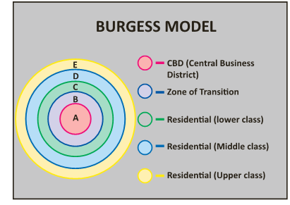
- This theory was given by Ernest Burgess in 1925.
- He envisaged that the development of a city outwards from a centre in concentric zones in a ripple-like fashion.
- He made the following assumptions:
- The city grows outwards in the form of five concentric zones or rings as long as there are no physical barriers, such as rivers or hills to distort the pattern.
- The city has a single centre.
- Growth is accomplished by a simple extension of each zone outwards into the next zone. The characteristic features of each of the five zones can be described as follows.
Zone A: The central business district (C.B.D)
- It is the heart of the urban community where the commercial, social and civic activities are concentrated.
- The heart of the C.B.D. or the downtown core has office buildings, departmental stores, theatres, hotels, banks and civic government buildings, while outside this core are warehouses and light industry.
Zone B: The transition zone next to the C.B.D
- It is the transition zone where the central business activities and factories mix and invade an area of aging residential dwellings.
- This is also the zone of residential decay where the new migrants come and live because the rents are low and transportation costs to the workplace are minimal.
- Thus, these are the sites of urban slums.
Zone C: The zone of independent working men’s home
- This zone is inhabited by the blue- collar workers who are generally the second generation migrants.
- These people have the capacity to own their individual houses away from the C.B.D., but still live within easy access of their workplace.
- Here, the family groups are more stable and crime rates are lower.
Zone D: The zone of better residence
- The next concentric zone has middle and upper class residences which are approximately 15 to 20 minutes by public transport from zone 1.
Zone E: The commuter zone
- This outer zone encircles the city and lies beyond the continuous built-up areas.
- Much of this zone is still an open space and is often located beyond the city limits.
- Here, small villages, surrounded by open country, gradually become suburbs.
- Since people in this zone work in the C.B.D., the commuter zone is located within one hour’s travelling time from the centre of the city.
- Burgess stressed that the outward growth of the city implies that each zone is not static.
- Business activities expand into the transition zone which forces low income groups to move outwards.
- This group, then, displaces the middle class and the wealthy that, in turn, are forced to move outwards.
Urbanization of the World and India
- Urbanisation refers to the population shift from rural to urban residency, the gradual increase in the proportion of people living in urban areas and the ways in which each society adapts to this change.
- It is predominantly the process by which towns and cities are formed and become larger as more people begin living and working in central areas.
- Although the two concepts are sometimes used interchangeably, urbanization should be distinguished from urban growth.
- Urbanization is “the proportion of the total national population living in areas classed as urban,” while urban growth refers to “the absolute number of people living in areas classed as urban“.
- The United Nations projected that half of the world’s population would live in urban areas at the end of 2008.
- It is predicted that by 2050 about 64% of the developing world and 86% of the developed world will be urbanized.
- That is equivalent to approximately 3 billion urbanites by 2050, much of which will occur in Africa and Asia.
- Notably, the United Nations has also recently projected that nearly all global population growth from 2017 to 2030 will be absorbed by cities, about 1.1 billion new urbanites over the next 13 years.
- Urbanisation in India began to accelerate after independence, due to the country’s adoption of a mixed economy, which gave rise to the development of the private sector.
- Urbanisation is taking place at a faster rate in India.
- Population residing in urban areas in India, according to 1901 census, was 11.4%. This count increased to 28.53% according to 2001 census, and crossing 30% as per 2011 census, standing at 31.16%.
- According to a survey by UN State of the World Population report in 2007, by 2030, 40.76% of country’s population is expected to reside in urban areas.
- As per World Bank, India, along with China, Indonesia, Nigeria, and the United States, will lead the world’s urban population surge by 2050.
- Mumbai saw large scale rural-urban migration in the 20th century.
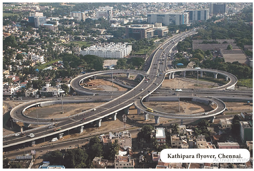
- Mumbai, in 2018, accommodates 22.1 million people, and is the largest metropolis by population in India, followed by Delhi with 18.6 million inhabitants.
- Witnessing the fastest rate of urbanisation in the world, as per 2011 census, Delhi’s population rises by 4.1%, Mumbai’s by 3.1% and Kolkata’s by 2% as per 2011 census compared to 2001 census.
Urban fringe
- Urban fringe is an area of transition between well recognized urban land uses and the area devoted to agriculture.
- It is an area where there is a mixture of rural and urban land uses and where a process of change from rural to urban land use is taking place.
- The urban fringe has the appearances of a proper city with residential and commercial centers, but it often lacks proper city services such as piped water supply, sewage and garbage disposal facilities.
- It may include the municipal towns and fully urbanized revenue villages contiguous to the main city.
Urban sprawl or suburban sprawl
- Urban sprawl or suburban sprawl describes the expansion of human population away from central urban areas into low-density, mono functional and usually car-dependent communities, in a process called suburbanization.
- In addition to describing a particular form of urbanization, the term also relates to the social and environmental consequences associated with this development.
- In Continental Europe the term “peri-urbanisation” is often used to denote similar dynamics and phenomena, although the term urban sprawl is currently being used by the European Environment Agency.
- There is widespread disagreement about what constitutes sprawl and how to quantify it.
- For example, some commentators measure sprawl only with the average number of residential units per acre in a given area.
- But others associate it with decentralization (spread of population without a well-defined centre), discontinuity (leap frog development), segregation of uses, and so forth.
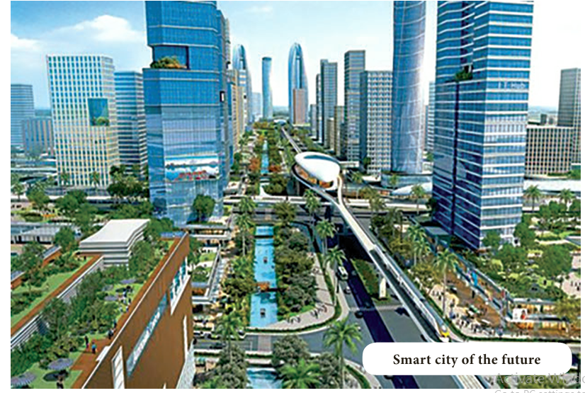
Causes of Urban Sprawl
- Urban sprawl can be caused by many factors.
- They are: Lower Land Rates: Lower cost land and houses in the outer suburbs of the cities, because the centers of urban development have really made people want to stop settling in these areas and want to venture further out.
Rise in Standard of Living:
- There are also increases in standards of living and average family incomes, which means that people have the ability to pay more to travel and commute longer distances to work and back home.
Lack of Urban Planning:
- People love to find areas that are less trafficked and more calm, which leads them to sprawl out to other sections of the town.
- Unprecedented development, cutting of trees, loss of green cover, long traffic jams and poor infrastructure force the people to move out to new areas.
Lower House Tax Rates:
- Cities will usually have high property taxes, and you can usually avoid these taxes by living in the outer suburbs because the taxes are usually lower than they are in other situations.
Rise in Population Growth:
- Another factor that contributes towards urban sprawl is rise in population growth.
- As number of people in a city grows beyond capacity, the local communities continue to spread farther and farther from city centers.
Consumer Preferences:
- People in high income groups have stronger preferences toward larger homes, more bedrooms, bigger balconies and bigger lawns.
- This also causes urban sprawl as this option is not available in crowded cities.
- People generally look out for low-density residential areas where they can get home according to their preference.
Problems of Urbanization
- India has the second largest urban population in the world only after China.
- India’s urban population (about 28% of the total population) is almost equal to the total population of USA.
- The rate of urban growth is on the upswing.
- People in large number are arriving in the mega and metropolitan cities, swelling urban India by more than five per cent annually.
- This stupendous growth of population is the cause of numerous socio-economic and environmental problems.
- Some of the important problems of urban India have been briefly presented below:
1. Problem of space and scarcity of residential accommodation
- The growing population demands more space which is not easily available because of physical and geographical constraints.
- The scarcity of space leads to high price of land and high rents for offices and residential accommodations.
- Since people cannot afford high rents, it is the main cause of unwanted growth of slums.
- According to one estimate, there is an annual shortage of about two million houses in Indian cities.
- This has forced low income group people to live in slums or occupy footpaths and road pavements.
- The number of such slums and pavement dwellers is rising in the metropolitan cities of India.
2. Inadequacy of Social Amenities
- In most of the cities of India, there is growth and not urbanisation.
- In fact, the number of people is increasing in the cities while the infrastructural facilities and civic amenities are quite inadequate.
- With greater concentration of people in urban places, the social amenities like housing, electricity, drinking water, transport, sanitation, sewage disposal, educational institutions, hospitals, parks, playgrounds, and recreational facilities are quite under great stress.
3. Unemployment
- Unemployment is the state of being involuntarily out of work.
- In India, the rate of urban unemployment which is more than 3 per cent annually is increasing progressively.
- According to one estimate, about 25 per cent of the workers in the urban centres are unemployed.
- The high rate of unemployment and under- employment often leads to high rate of crime.
4. Problem of Transport
- Transport bottlenecks and traffic congestion are the major problems of most of the Indian cities.
- The larger a town grows the more important its functions become.
- The workers and commuters need more transport facilities.
- Unfortunately, the roads in most of the cities, especially in the old towns (down-towns) are narrow which cannot cope with the growing pressure of passengers, travelers, and commuters.
- The number of private vehicles is rising steeply.
- It leads to traffic congestion, delays, irritation, and tension.
- If the number of vehicles is allowed to increase at the present rate without widening and upgrading the roads, the whole transport system of the major cities may collapse.
5. The Energy Crisis
- The shortage of energy reduces the industrial production of goods and their distribution.
- In fact, energy depends on the industrial growth, efficiency of the transport and human comfort.
- The peak power demand in the metropolises, million and class one cities is increasing day by day and power situation is not geared to meet it.
6. Inadequacy of Water Supply
- Water is the first and foremost necessity of human life.
- In fact, water is life, and man cannot survive without it.
- The average per capita consumption of water in Kolkata is 250 litres, in Mumbai175 litres and only 80 litres in Delhi as against 1200 litres in Los Angles and 1100 litres in Chicago.
- The acute scarcity of water in the urban places of India may be appreciated from the fact that in Chennai, Hyderabad, Jaipur, Jodhpur, Nagpur, Shimla, Solan, Surat, Udaipur, Vadodara, etc., only one to two hours of water supply in a day is permitted.
- The National Capital (New Delhi) also regulates water supply to only about four hours a day.
7. Environmental Pollution
- Environmental pollution is the other serious problem of all the million and mega-cities.
- It is not only air-pollution caused by smoke emitted from vehicles, factories and houses; water and noise pollutions are equally serious.
- The scarcity of dumping grounds makes the rural- urban fringe unhygienic and less conducive for human health.
- The problem of garbage disposal (hazardous plastics, metal and package) is thus quite serious in most of the Indian cities and urban places.
- Unfortunately, most of the garbage is dumped into the rivers or along their banks.
- The cities like Mumbai, Kolkata, and Chennai continue to discharge a major part of their garbage into the sea.
8. Increase in Crimes
- Increasing urban crimes are disturbing the peace of modern cities.
- According to sociologists, unemployment is the main cause of crimes in urban areas.
- The unemployed youths indulge in crime like abduction, extortion, kidnapping, murder, pick-pocketing, rape, robbery, snatching, and theft.
- The slums are especially infested with unemployed criminals who, in due course of time, become habitual offenders.
- Material culture, growing consumerism, selfishness, stiff competition, lavishness, increasing socio-economic disparities, rising unemployment and loneliness are some of the main reasons of this menace.
MORE TO KNOW:
Kraal
- Kraal is a group of houses surrounding an enclosure for livestock, or the social unit that inhabits these structures.
- The term has been more broadly used to describe the way of life associated with the kraal that is found among some African, especially South African, peoples.
- Kraal consists of a number of huts arranged in a circle around a cattle corral.
- Polygyny is common, and each wife has her own hut within the kraal.
- The head of the kraal may have custody of the property attached to the houses of his several wives.
Ecumenopolis
- Ecumenopolis (Ecumeno means world; polis means city) is a single city encompassing the whole world that is held to be a possibility of the future.